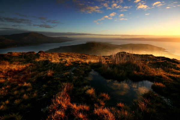
The walks form part of the Beara Way and guide you past sites which reveal Bere Island’s rich military heritage. Guided heritage walks are available throughout the summer. Wherever you walk on Bere Island, the views back across Beara, the Slieve Miskish and the Caha mountains are simply breathtaking. Walks begin at both ferry points: Rerrin village (East End) accessible from the pontoon ferry, and Oileán na gCaorach (West End), accessible from Castletownbere.
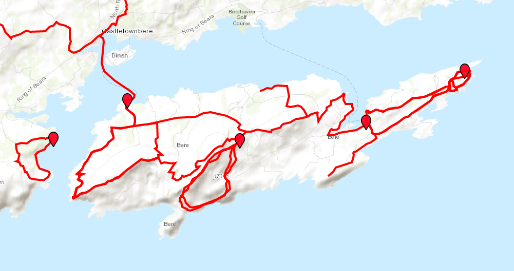
Bere Island’s walkways are incorporated in the larger Beara Way, which extends over the whole of the Beara peninsula, with over 220 kilometres of trails. However, Bere island hosts some of the Beara Way’s highlights, with sites of rich military heritage of various eras, as well as spectacular and breathtaking scenery of the mainland’s Slieve Miskish and Caha Mountains, unique to Bere Island’s offshore position.
NB: If you are driving to the start of any of the looped walks, please park responsibly and do not block gates or entrances to properties.
Walkers are spoilt for choice on Bere Island, with routes of varying difficulty guiding visitors along picturesque byways and through more rugged terrain.
Island Walks
Main Beara Way
Length: 19km
Estimated Time: 7-8hrs
Terrain: Varied
Level of Difficulty: Varied, with easy ambles along country roads to hills which are more suited to the experienced walker. Opportunities exist to shorten the walk dramatically.
Starting Point: Either Ferry point
Sights: Stretches from East to West of the Island, taking in many of the Island’s sights.
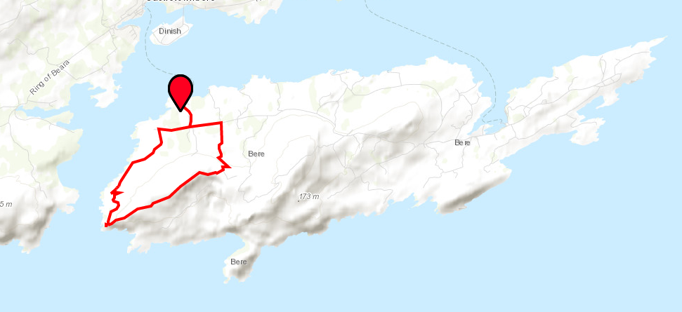
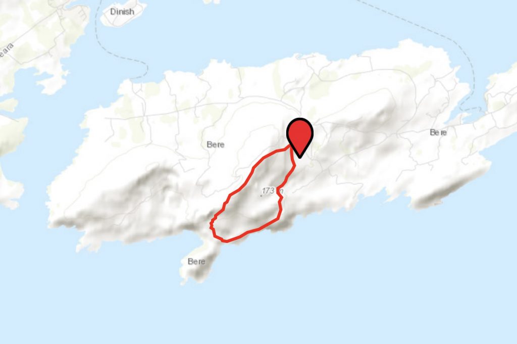
ArdnaKinna Lighthouse Loop
Length: 11km
Estimated Time: 4-5hrs
Terrain: Varied, including some difficult rugged sections.
Level of Difficulty: Moderate to Difficult
Starting Point: West End
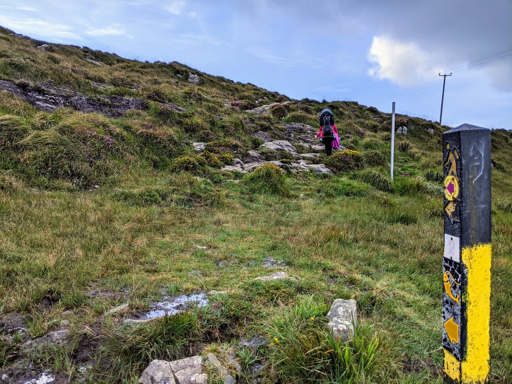
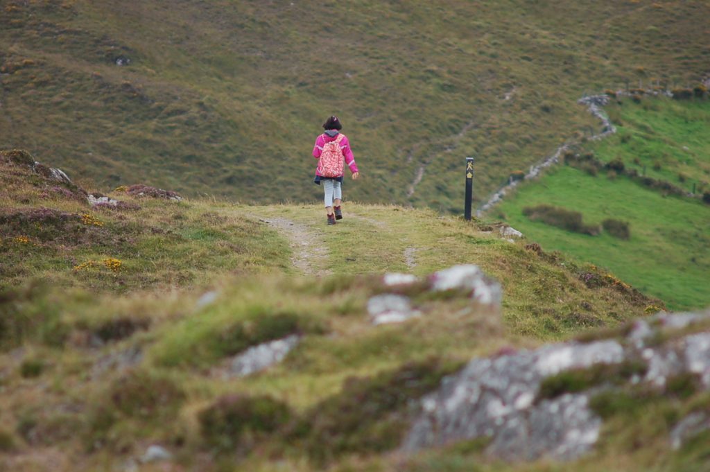
Waymarking: Purple arrow
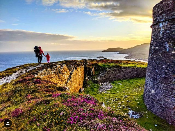
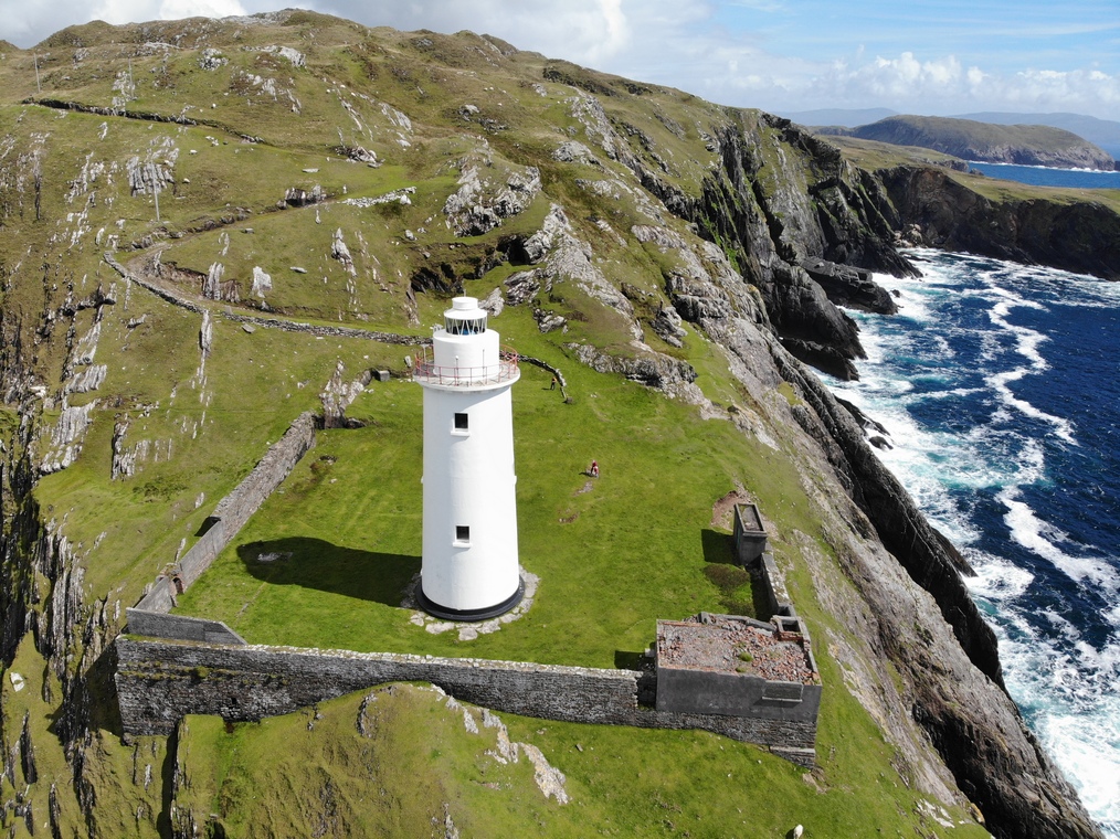
Sights: The track heads west and then south on an old military track. Ardnakinna lighthouse is in itself a must-see on Bere. There was originally a beacon built here in 1850, with the present lighthouse lit in 1965. The rugged track to the lighthouse along the coastline provides stunning views back onto the mainland, whilst the area around the lighthouse provides a perfect picnic spot with views of Sheep’s Head, the Mizen, and west to Dursey Island.
Lat. and Long. 51.63886, -9.89924
Doonbeg Loop
Length: 5km
Estimated Time: 3hrs
Terrain: Varied, some steep sections
Level of Difficulty: Moderate to difficult
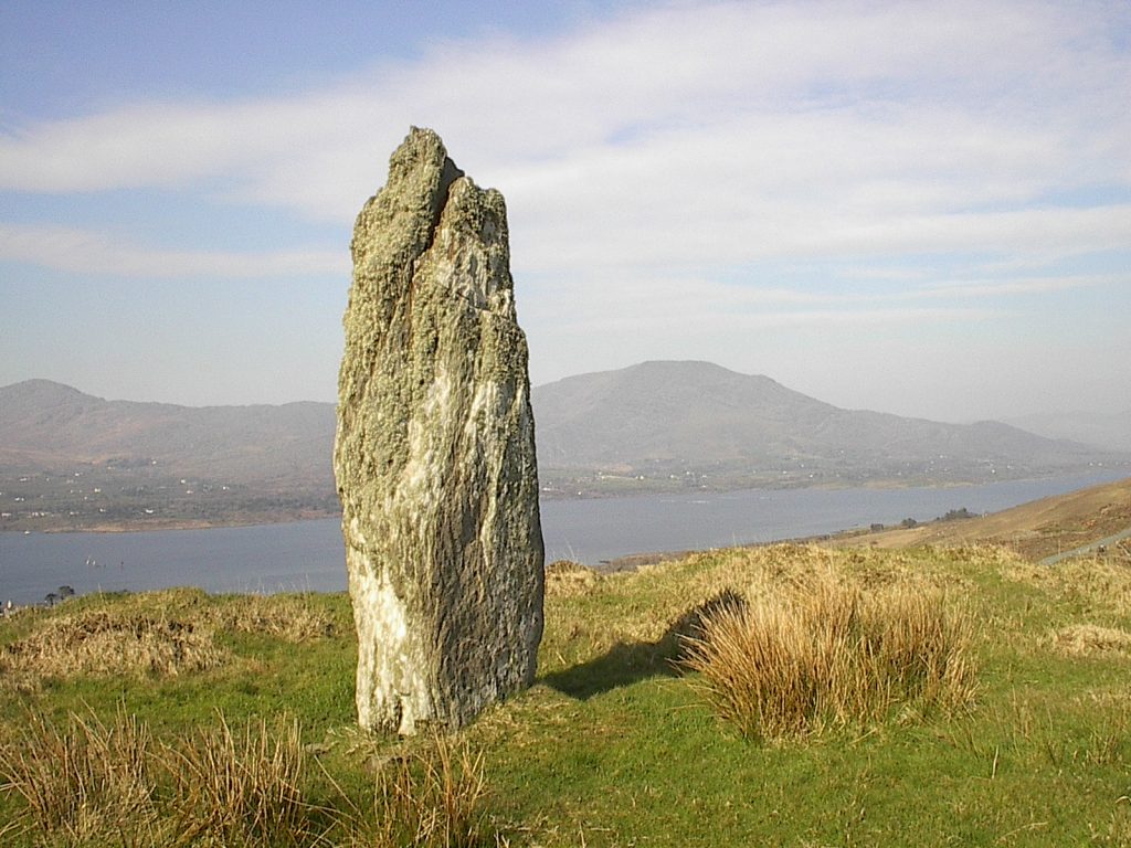
Starting Point: Middle of the island, just south of the Gallán (standing stone)
Waymarking: Orange arrow
Sights: This takes in beautiful views to the south of Sheep’s head and the Mizen peninsula.
Lat. and Long. 51.63054, -9.861676
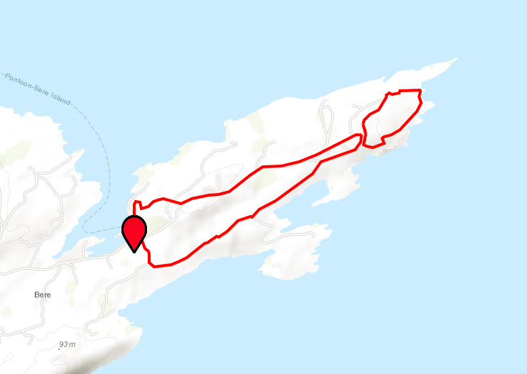
Rerrin Loop
Length: 6 km, although can be shortened
Estimated Time: 2-3hrs
Terrain: Flat, predominately along the road
Level of Difficulty: Easy to Moderate
Starting Point: East End (Rerrin) ferry point
Waymarking Purple arrow
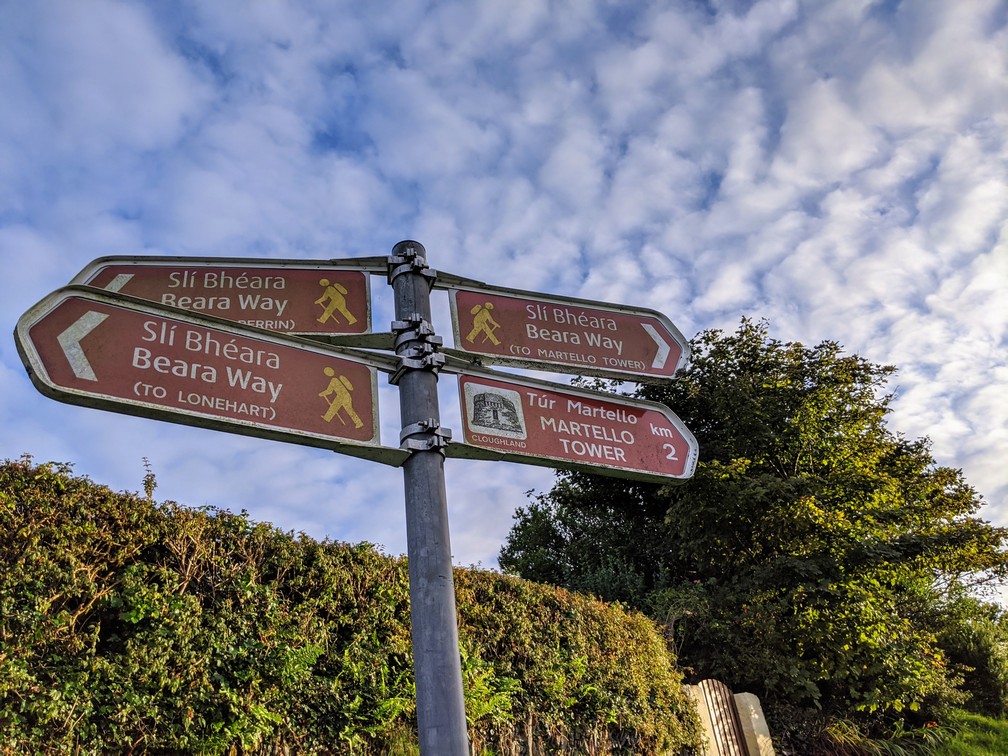
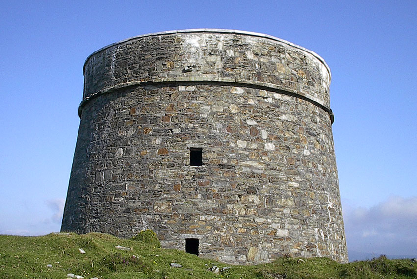
Sights: This route encompasses several sites of historical importance, including the British fortification at Lonehort. It also takes in views of Martello towers, Ardaragh Wedge tomb, and a Viking shipyard. This is essential viewing for the military enthusiasts.
Lat. and Long. 51.63443, -9.81939
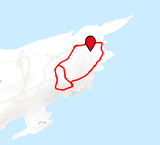
Lonehort Heritage Trail
Length: 2km
Estimated Time: 30 mins
Terrain: Flat on grass
Level of Difficulty: Easy
Waymarking Brown finger signs
Starting Point: Lonehort Battery, in the eastern end of the island. This walks adjoins the Rerrin Loop.
Sights: Walk around the notorious site of a British Battery, taking in the massive trench, the two 6 inch barrelled guns and many other structures.